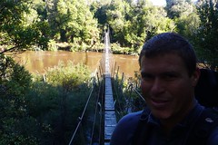
Woke up early to bluebird skies and a light offshore breeze. I ran out through the flax down to the beach for my first clear view of the bay. It's absolutely huge. The beach is literally over 3 miles long between the two rivermouths. The south side of the bay stretches about 8 miles out from the beach and the north about 6. I quickly made up my porridge breakfast and coffee, packed up my gear for the day and headed through the forest to the swing bridge to cross the river. The path through was a muddy bog after the past two days of rain. I was shin deep in mud 20 feet up from the river! Another barely marked deer trail to get back to the beach where I had to cross a waist deep river anyways. It took me about an hour to go 2 km's. I still had about 5-6 km's to go....
I kept up a steady pace jumping from rock to rock, but soon saw the wind starting to come up from the west making my chances for a surf slim. I made it to Crayfish Rock and had a good look at the best wave in the bay. A great looking right point breaking mechanically over large boulders. Unfortunately, the wind had kicked in and was blowing out the head-high waves. Pretty difficult to be on it here when the wind can change direction 4 times in 20 minutes and the hut is a 2 1/2 hour walk from the break. Should've brought a tent.... I decided to have a little lunch and go fishing. It was a beautiful sunny day and somebody must have felt sorry about the waves being blown out so I actually caught not just one but two fish. I'm calling em blue cod but truth be told I'm not really sure what they were. I had to throw them back anyways cause they were definitely on the small side.
After another 1 1/2 hours tramping back along the north side of the bay I reached the rivermouth. The mouth itself was looking mighty ferocious so I walked up the river for a bit and found what looked to be a good spot to cross. I put my camera in my waterproof bag, stripped down to my speedos and started wading across. The glacial runoff was pretty chilly but luckily it was only waist deep keeping my backpack out of the water. The river was about 40 yards across at this point so I was able to make it across pretty quickly. I jogged up the beach to warm back up and then thought I'd better change back into some pants before heading back to the hut just in case someone had shown up. It had been 3 days since I'd seen another person. Talk about solitude... Luckily I had changed clothes because Philip from Germany had arrived. Really nice guy, crazy enough to attempt the Pyke River Route on his own. I've heard you sometimes have waist to chest deep river crossings when it's been dry. I can't imagine how Philip will find it on his own. I gave him an extra gas canister for his stove in case he had to wait for the water levels to drop somewhere. It was nice to have a little company that night.
Subscribe to:
Post Comments (Atom)

2 comments:
hi mike ,, what a great naritive i felt i was with you every step of the way.... when i was googling big bay ,,,hedda set me up pretty good with google info,,,when i came down from satellite view it landed me in the middle of big bay just water texture with white caps i had no idea where i was i monkeyed around with the control a bit a found land...........wow big bay is big and i could see the two river mouths,,,i thought might produce,,,some juice... i even went beyond both points but didn't see much.. we need to design a hand held google earthy,,,,so you can see from the sky where the hell you are! but i don't know what about the fun of finding out what is around the corner and up the bend love googling dad
Hi,we have lived in and out of bay all our lives so its very interesting to read your comments, we hike in and out of the bay almost every year, its a long way to cary a surfboard so i don't do that any more, but it always surprises me how people seem to lose the tracks,
Post a Comment